24th Oct 2021
After climbing Lugnaquilla during the summer, the next mountain I had on the list was one higher up on the list of Ireland’s highest mountains.
And so it was, having waited for favourable weather conditions since the summer, I had planned to climb Mount Brandon, on the Dingle Peninsula, in County Kerry.
This was my second time climbing this mountain, having climbed it previously in 2001.
I know from research, and from the last time I was up there, that it was a small car park, so I figured that I would have to start making my way there in the early hours of the morning in order to give myself any chance of getting a parking space. And also heading up to the summit, and back, before it starts to get dark.
Ad by Google
It was approaching 9 when I arrived at Dingle. My intention was to make an in-car video clip coming into Dingle, which I will include at the very start of the YouTube video. If you look at this video, those 35 seconds or so, is a sequence of still shots. I will let you make up your own mind as to whether or not this was intentional.
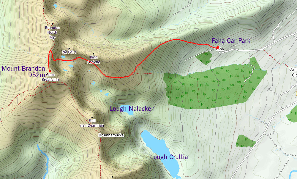
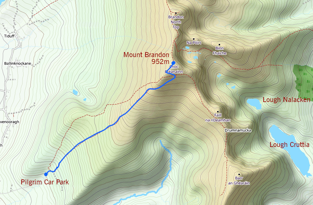
Now there are two popular routes up to the summit. The first is the Faha Route, which I did take, which starts at a small car park, on the east side, and the other route, known as the Pilgrim Route, which approaches the mountain from the west.
Each route has its own advantages and disadvantages. While the Faha route is more strenuous in places (you need to use both hands and feet to manoeuvre through the most difficult parts of what could almost be described as a “cliff”) there are more dramatic views along the way up, not least of these of a series of pater noster lakes to the east side of Mount Brandon.

The Pilgrim Route is less severe, and would be more suitable for younger and less experienced climbers. And the views you will get along the way up this route, cloud cover permitting, include all on the west of the Dingle Peninsula, and even the Blasket Islands.

To get to the Faha Car Park, from Dingle involves heading up along the famed Conor Pass. On a clear day, you should be able to see the pater noster lakes on your left as you head towards the car park.
After negotiating a few twisty narrow roads from the Conor Pass, I finally arrived at the car park. There were only 8 spaces, and of course, there is always the possibility that some moron will decide to take up two spaces!
Ad by Google
I recorded the intro for the video, and then it was time to start the climb.
If my memory serves me correctly from the last time I climbed the mountain, there were stakes positioned at regular intervals along the route, to guide the climber on the way up. There didn’t seem to be as many stakes there now; you are relying on the beaten track to keep you on course. The route from the car park to where the pater noster lakes come into view is for the most part uneventful, just a somewhat regular rate of ascent. Apart from, that is, a grotto, and the site of where one of four planes crashed on the mountain in the 1940s. You will see a block of a radial engine from one of these aircraft, which has badly corroded over the 80-odd years.
The route will then take us into a gorge, where there is a series of pater noster lakes, or small lakes which are connected in series by a single steam. We would be staying upstream of these.
Eventually you will face what could be considered a cliff face. That said, you won’t need climbing gear, although appropriate footwear is essential, and it will be necessary to use your hands and feet to help you manoeuvre some parts of the climb. The most important thing is to take your time.
The cliff won’t go on forever, and you will finally reach the top of it, and will be greeted to a spectacular view to the north of the Dingle Peninsula, cloud cover permitting.
After a relatively short but steep scramble from the top of the cliff face, we finally reach the summit of Mount Brandon. And much of the clouds that were there at the start of the climb were burned away on the way up, along the lines of what the weather forecast I was relying on, had predicted. I stayed around the summit for just over half an hour, during which time there were some spectacular views of the peninsula, although much of the peninsula to the west of Mount Brandon was covered in a bed of clouds.
Eventually, it was time to start heading back down. As always, when you are on a mountain such as this, you go down at the same speed as you went up, and you take the same precautions.
Ad by Google
I figured it would help to break down the descent route back to the car park. From the summit to the top of the cliff. Down the cliff face. Through the gorge. Past the plane crash site. Over a number of stiles that help you over fences. Past the grotto. And finally, back to the car park, less than an hour before sunset.
After the climb, it was my intention to head back to Dingle, to make the outro segment of the video, go for a walk around the town, before making the journey home.
I had planned that climb during the summer, not too long after climbing Lugnaquilla. However, during that time, there were hot days, with the mercury hitting the 30s (degrees Celsius), and a part of me would be inclined to consider that to be too much. And then there were wet days (which were out of the question for climbing), and finally an opportunity with favourable weather conditions presented itself.
It doesn’t have to be totally cloudless for the climb. Sometimes you could have a sprinkling of clouds at just the right spots, and that could make for more dramatic images than one without clouds. And it’s not just about going out to take photos. Often, it’s all about getting out there and embracing the scenery at the end of the day.